
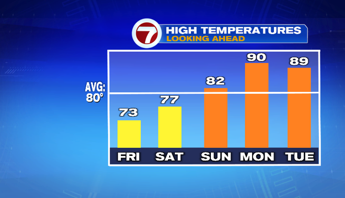
What a dramatic drop in temperatures we’ve had this afternoon and evening! Temperatures are cool and the air feels comfortable. Temperatures are going to stay below average again tomorrow and likely for most of us on Saturday.
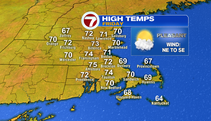
Open the windows tonight! Temperatures fall into the upper 50s/low 60s. We’ll wake up to a lot of clouds tomorrow morning. Through the day, we’ll see decreasing cloud cover. A northeast wind shifts southeast. Highs will be in the upper 60s/near 70 for the coast. Inland temperatures reach the low/mid 70s. It’s a pleasant end to the work week.
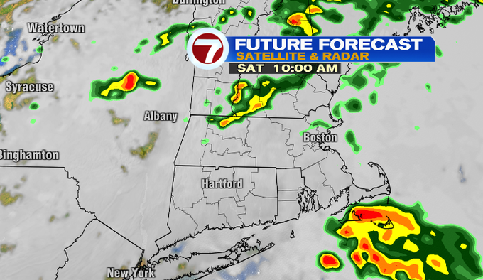
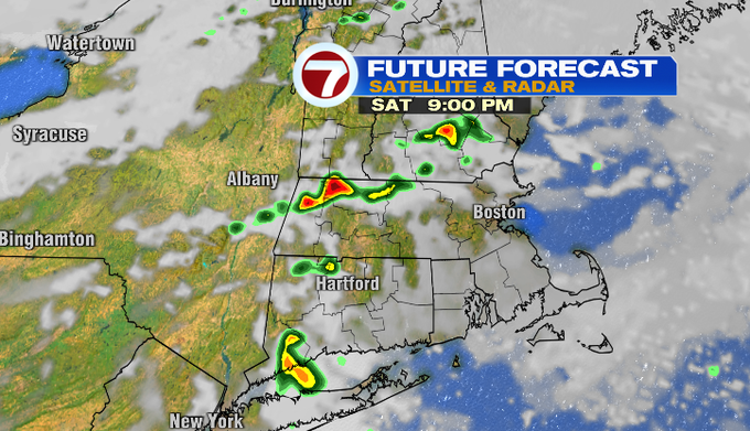
A frontal boundary has been to our south today keeping the clouds and light showers around. By Saturday, a warm front lifts through bringing some showers and a storm chance in the morning. We’ll get a break by the early afternoon. In the evening, there’s another chance for a shower or storm out ahead of a cold front. The timing looks to be more toward the evening and night.
Sunday will be the warmer day in the upper 70s/low 80s. Next week the heat and humidity combo returns! Highs will be near 90 especially for Monday-Wednesday.
-Meteorologist Melanie Black