Finally! After a record day yesterday across the area, temperatures are going down today, but especially for Thursday and Friday. Today is still a hot day, don’t get me wrong, but it’s more of your classic summertime heat versus the extreme record setting heat we had yesterday. We still have a heat advisory in effect for today, but it’s downgraded from the extreme heat warning Monday and Tuesday. And notice, not everyone is included as a sea breeze keeps the coast line a bit cooler.

Highs will climb to the 90s again for most of us today, with heat indices up to 102°. Some relief will be felt on the coast with highs capping in the 80s before the sea breeze kicks in. There’s a low chance of a passing shower or storm this afternoon and evening, but most of us will stay dry.

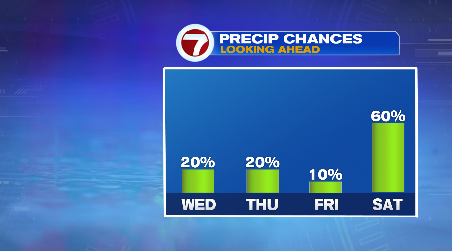
As we work the heat out over the next couple of days, rain chances will go up… somewhat. These are not great rain chances in any stretch of the imagination but each day for the rest of the work week may feature a passing shower or storm.
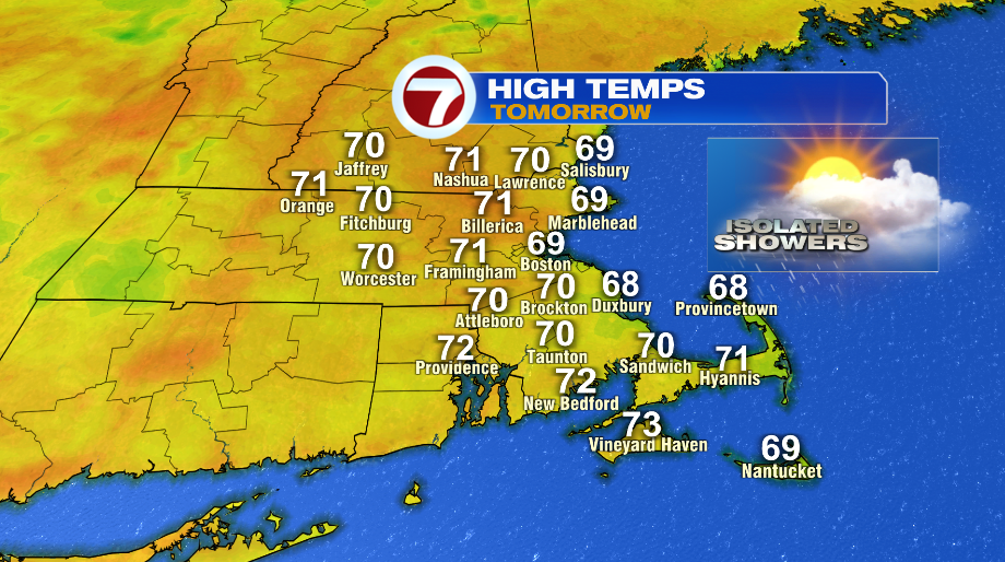
So where’s the relief? Thursday! Thursday will be quite the chance with high temperatures that will top out only near 70°!