
Good morning! We have two rounds of showers and storms today. The initial round could bring some heavy rain to the South Coast, Cape and Islands this morning. The second round will bring the threat for scattered storms that could be severe. The biggest threats would be damaging wind, hail and lightning.
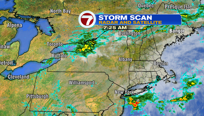
The initial round is associated with a warm front and the batch of storms south of Long Island above. The second round is out ahead of a cold front draped near New York and the Great Lakes.
Here’s the timing…
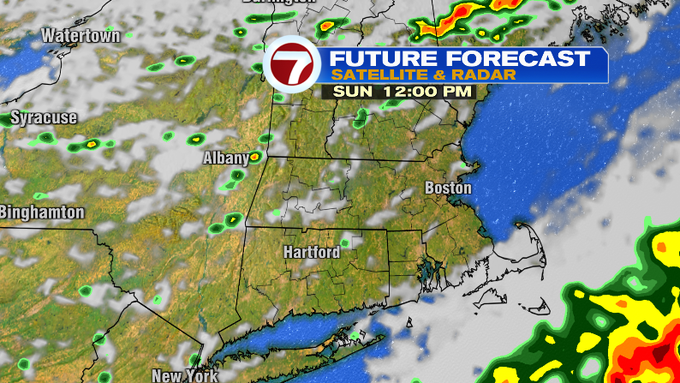
Showers and heavy rain could impact the South Coast, Cape and Islands this morning through about midday. Clouds will clear for some sunshine inland. It will be warm and humid at this point. The second round of storms starts to get going around 2 pm. The threat will continue to develop and slide southeast through the evening. You can see the possible timing on Future Forecast below. The storm threat should diminish around 10 pm.


The developing sunshine and southwest wind will boost temperatures into the mid/upper 80s inland. Clouds will linger for the Cape and Islands, so I expect high temperatures to be in the upper 70s.

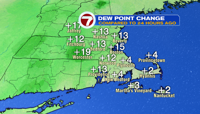
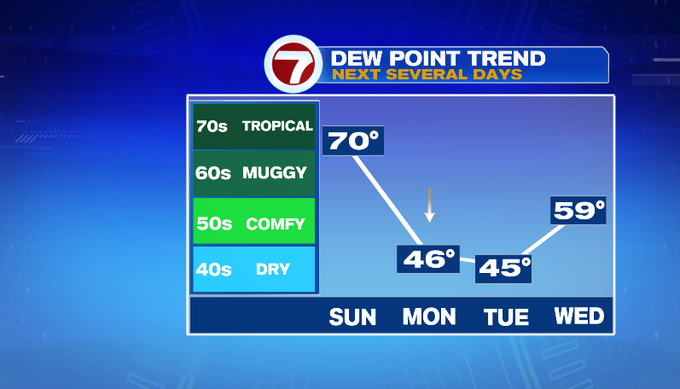
There’s a noticeable difference in the air today! Dew points jumped into the 60s. Drier air works in on a wind shift and northwest wind overnight. Dew points will continue to drop tomorrow. We’ll get dry and refreshing air through Tuesday!
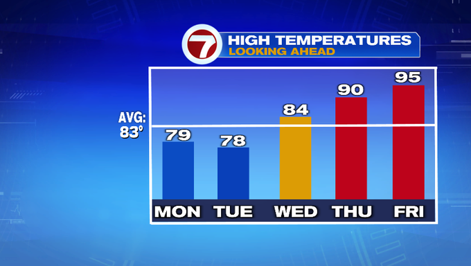
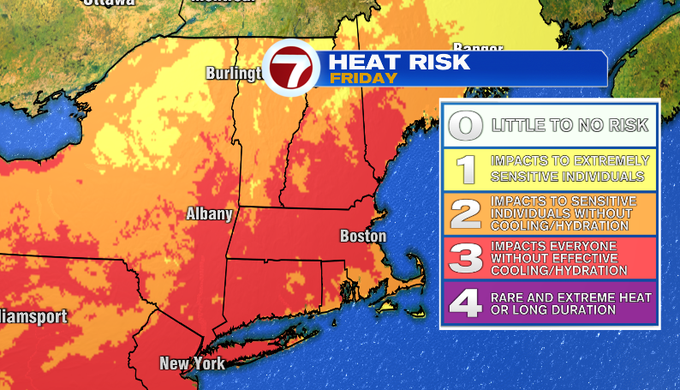
We go back up on the temperature roller coast to end the week with the return of heat and humidity. Friday could pose a heat risk with feels like temperatures in the mid 90s to near 100.
The threat for storms returns on Friday.
-MB